
Foggy Bottom Streetscape Plan
The university recognizes the positive impact that open spaces, pedestrian pathways, and streetscape provide as a counterbalance to the surrounding built urban environment for those who study, work, and live in Foggy Bottom. Accordingly, the Campus Plan proposes to improve pedestrian connectivity through the campus, enhance open spaces, and promote the use of sustainable streetscape elements.
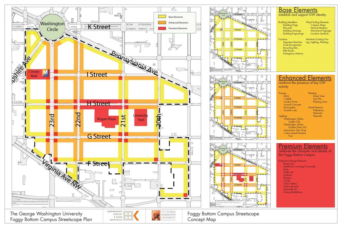
An implementation plan and standards regarding various streetscape components (including landscaping, street signage, lighting, and street furniture) are addressed in the draft Foggy Bottom Streetscape Plan (.pdf). The proposed Foggy Bottom Streetscape Plan, developed in coordination with the DC Office of Planning (OP) and representatives from the DC Department of Transportation (DDOT), is included as an exhibit to the 2007 Foggy Bottom Campus Plan.
In addition to numerous discussions and presentations throughout the 2005 Community Based Planning Process to prepare GW's draft 2007 Foggy Bottom Campus Plan, the university has conducted ongoing outreach and updates as the Streetscape Plan was refined and developed through continued collaboration between representatives of the university, DCOP, and DDOT, as well as with the participation and input of interested stakeholders. Open community meetings were held in both 2006 and 2009 to discuss the draft plan and additional updates were given at the quarterly GW/Community Advisory Committee meetings from 2007 to present.
Ultimately, it is intended for the Streetscape Plan to serve as a comprehensive planning resource to complement the development plan set forth in the 2007 Foggy Bottom Campus Plan as well as the proposed Foggy Bottom Campus Historic Preservation Plan.
Related Streetscape Documents
- August 2010 Draft Streetscape Plan (PDF)
- June 15, 2009 Community Presentation (PDF)
- June 15, 2009 Public Notice (PDF)
- May 6, 2009 Community Presentation (PDF)
- May 6, 2009 Public Notice (PDF)
- July 13, 2006 Draft Campus Plan Exhibit X (PDF)
- August 25, 2006 Draft Campus Plan Exhibit X (PDF)